Log in
All resources
Create a design
33,600 Free Images of 1726 Maps
maps in the library of congress
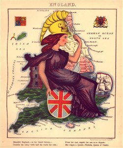
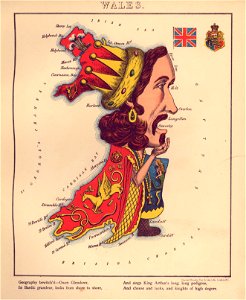
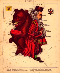
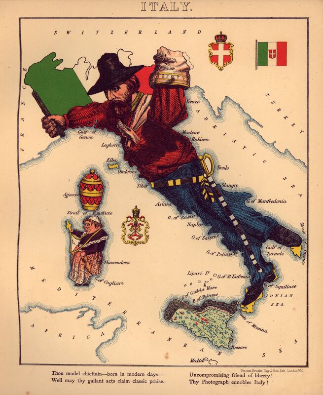
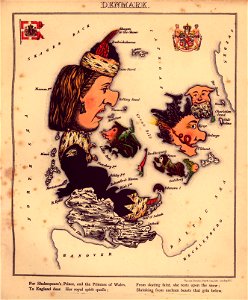
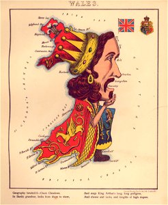
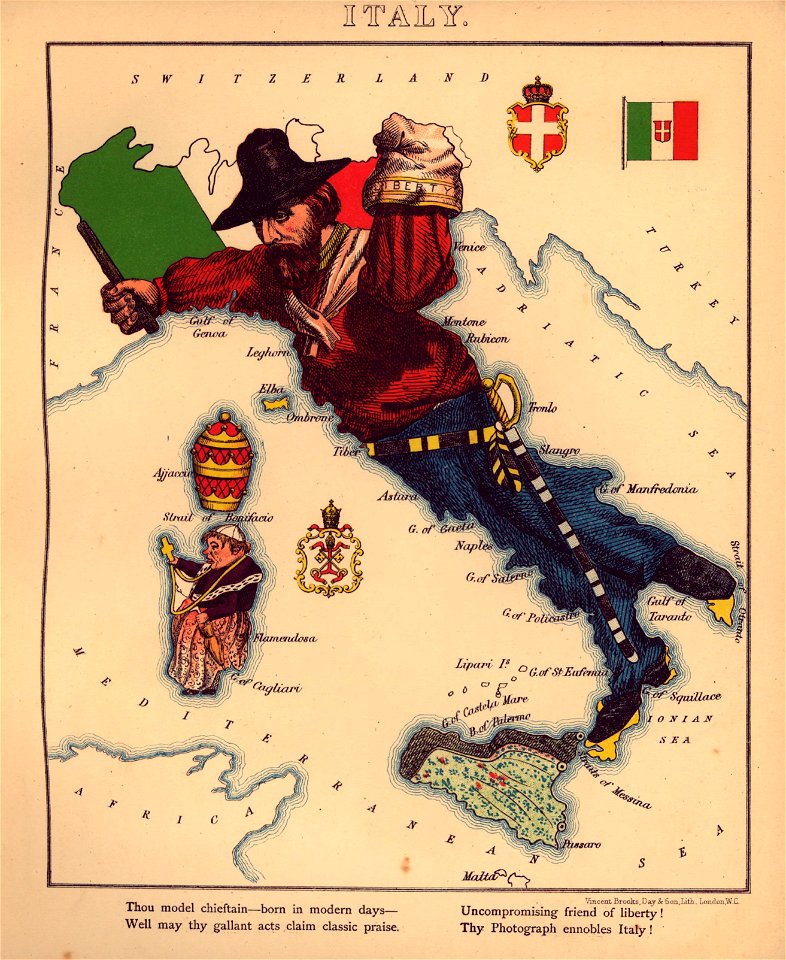
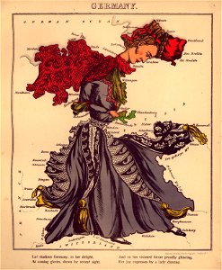
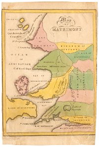
geographical fun - being humourous outlines of various countries
with an introduction and descriptive lines
engraving
cartography
chalcography
grabados
fondo antiguo
calcografía
cartografía
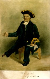
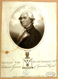
greenwich pensioners
printing
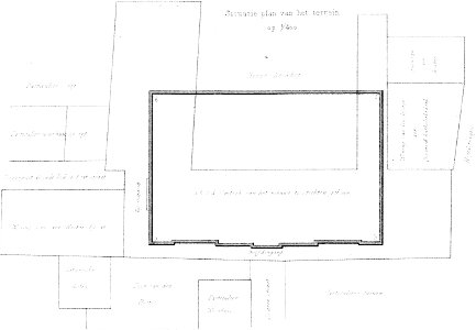
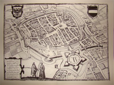
demolished buildings in groningen (city)
old maps of groningen (city)
norway, sweden, and denmark- with excursions to iceland and spitzbergen; handbook for travellers (1909)
maps of skansen
architecture
maps
cartography
maps
cartography
maps
architecture
maps
cartography
maps
cartography
maps
cartography
maps
maps from the earth and its inhabitants, vol. vi
charles eugène perron
torquato tasso in art
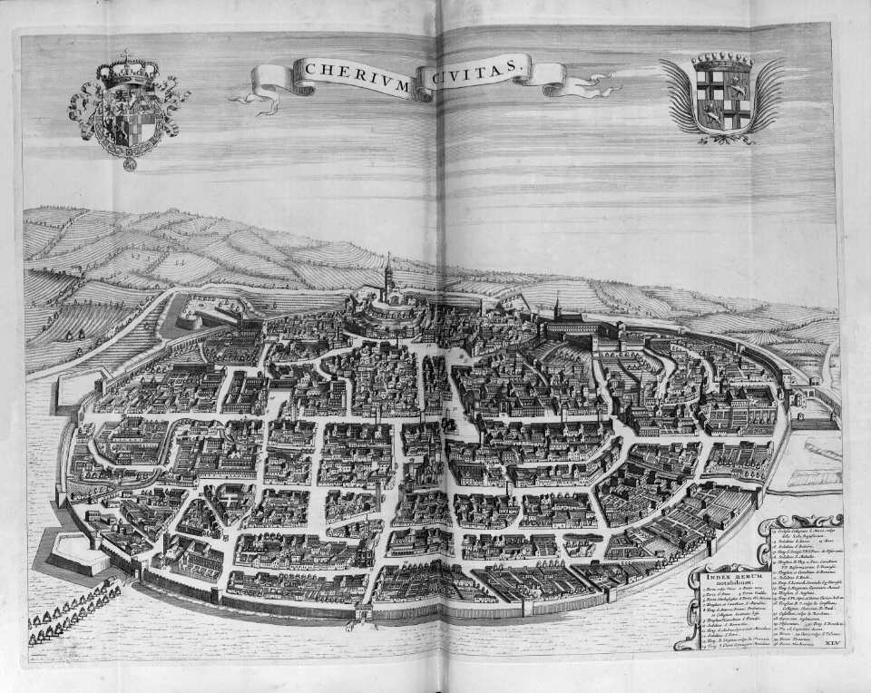
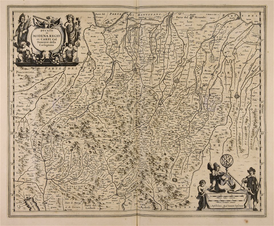
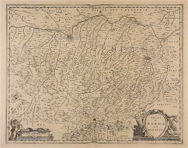
italian-language maps
cartography
maps
cartography
maps
cartography
maps
cartography
maps
cartography
maps
nicolas étienne edelinck
antonio david
historical images of melaka city
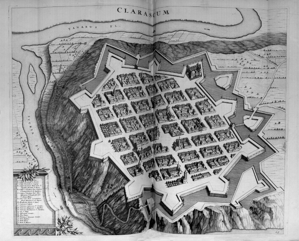
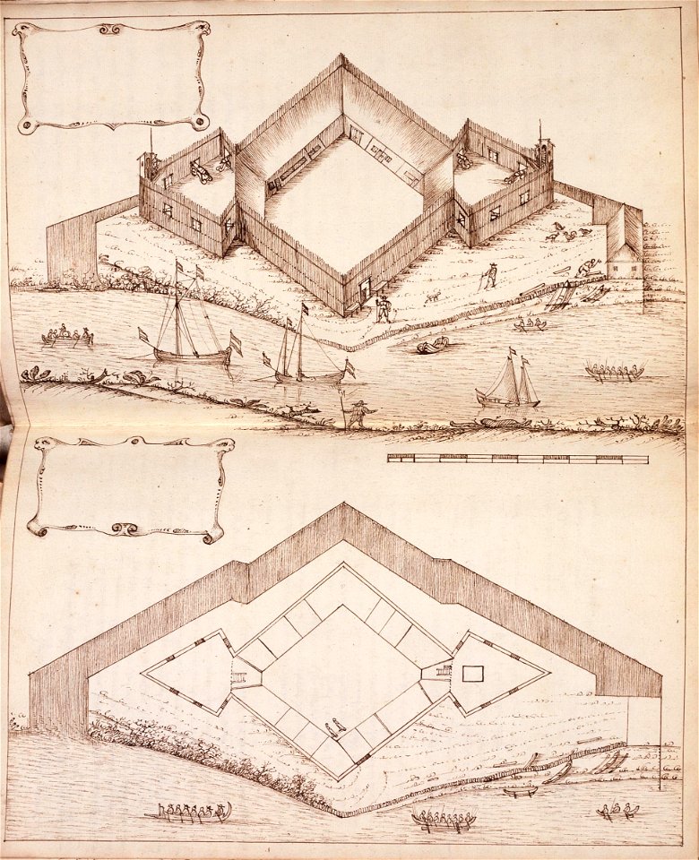
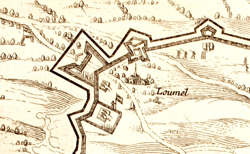
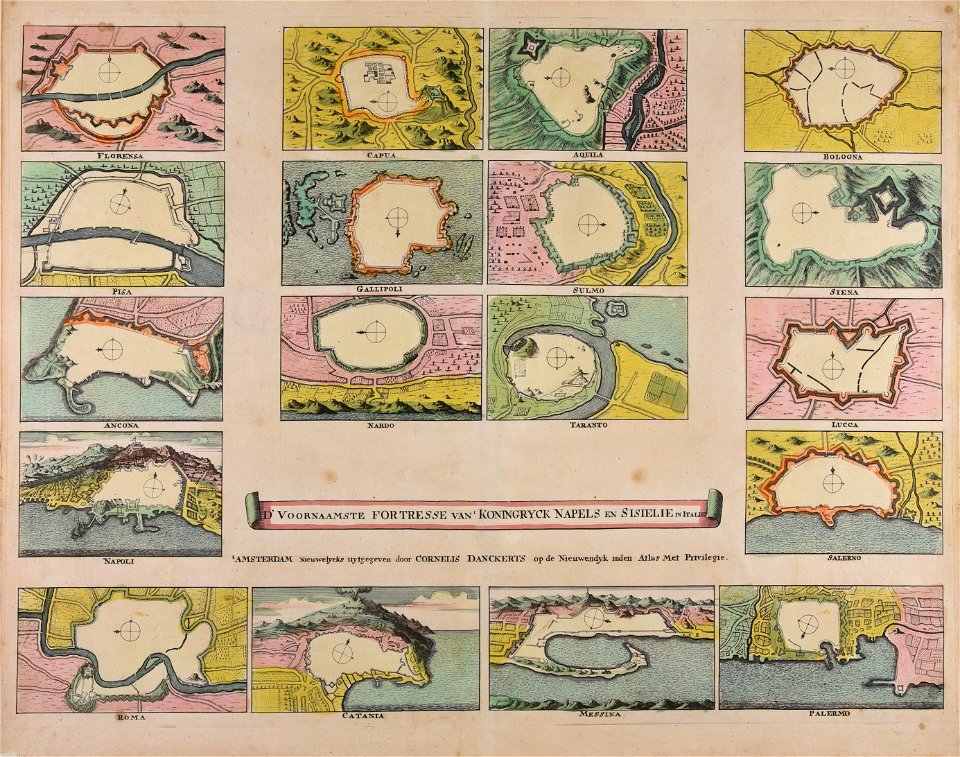
18th-century fortress plans
coats of arms of groningen (city)
braun & hogenberg
maps in the library of congress
western europe
maps in the library of congress
western europe
maps in the library of congress
western europe
maps in the library of congress
western europe
maps in the library of congress
western europe
maps in the library of congress
western europe
maps made in the 17th century
jan janssonius
maps made in the 17th century
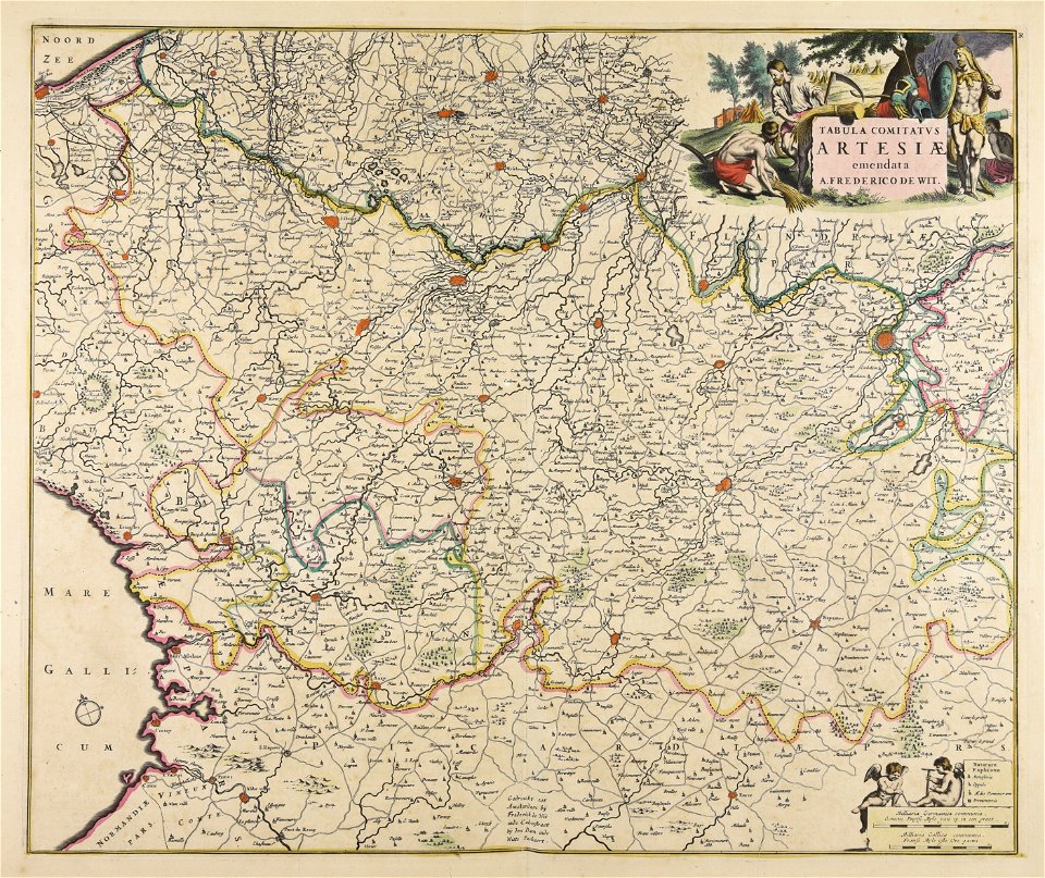
frederick de wit
prints of cartouches in the rijksmuseum amsterdam
old maps of valletta
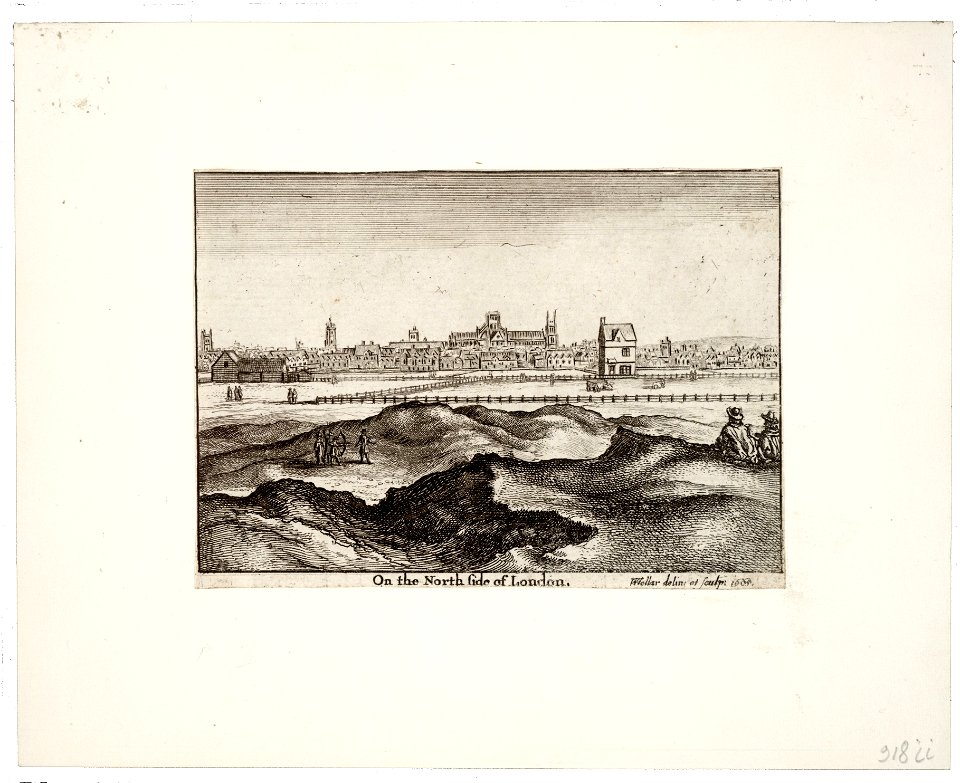
prints by wenzel hollar
views of london
architectural prints by wenzel hollar
southwark cathedral
joyce gold
printing
maps made in the 18th century
jeremias wolff
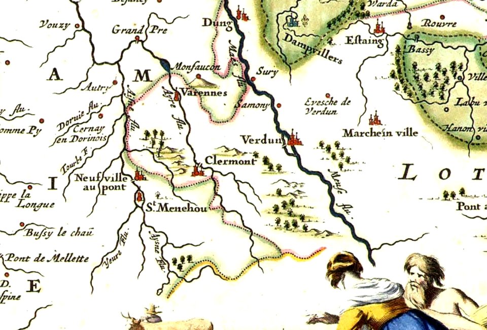
varennes-en-argonne
argonne
images of venice by jacopo de' barbari
barbary
18th-century engraved oval portraits of men at bust length
joseph banks in art
maps of the dutch east india company - indonesia
1646 drawings in indonesia
oude kerk amsterdam in art
frederick de wit
maps made in the 17th century
jan janssonius
maps made in the 17th century
jan janssonius
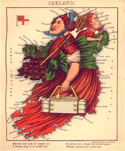
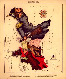
geographical fun - being humourous outlines of various countries
maps in the library of congress
geographical fun - being humourous outlines of various countries
maps in the library of congress
geographical fun - being humourous outlines of various countries
maps in the library of congress
geographical fun - being humourous outlines of various countries
maps in the library of congress
maps made in the 17th century
nicolaes visscher ii
geographical fun - being humourous outlines of various countries
maps in the library of congress
geographical fun - being humourous outlines of various countries
maps in the library of congress
geographical fun - being humourous outlines of various countries
maps in the library of congress
geographical fun - being humourous outlines of various countries
maps in the library of congress
geographical fun - being humourous outlines of various countries
maps in the library of congress
geographical fun - being humourous outlines of various countries
maps in the library of congress
geographical fun - being humourous outlines of various countries
maps in the library of congress
geographical fun - being humourous outlines of various countries
maps in the library of congress
geographical fun - being humourous outlines of various countries
maps in the library of congress
geographical fun - being humourous outlines of various countries
maps in the library of congress
geographical fun - being humourous outlines of various countries
maps in the library of congress
geographical fun - being humourous outlines of various countries
maps in the library of congress
geographical fun - being humourous outlines of various countries
maps in the library of congress
geographical fun - being humourous outlines of various countries
maps in the library of congress
geographical fun - being humourous outlines of various countries
maps in the library of congress
geographical fun - being humourous outlines of various countries
maps in the library of congress
geographical fun - being humourous outlines of various countries
maps in the library of congress
geographical fun - being humourous outlines of various countries
maps in the library of congress
geographical fun - being humourous outlines of various countries
maps in the library of congress
geographical fun - being humourous outlines of various countries
maps in the library of congress
geographical fun - being humourous outlines of various countries
maps in the library of congress
geographical fun - being humourous outlines of various countries
maps in the library of congress
geographical fun - being humourous outlines of various countries
maps in the library of congress
geographical fun - being humourous outlines of various countries
maps in the library of congress
geographical fun - being humourous outlines of various countries
maps in the library of congress
geographical fun - being humourous outlines of various countries
maps in the library of congress
geographical fun - being humourous outlines of various countries
maps in the library of congress
geographical fun - being humourous outlines of various countries
maps in the library of congress
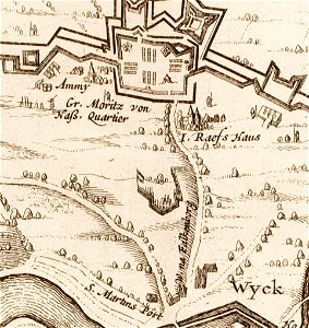
17th-century maps of maastricht
limmel (maastricht)
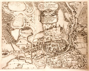
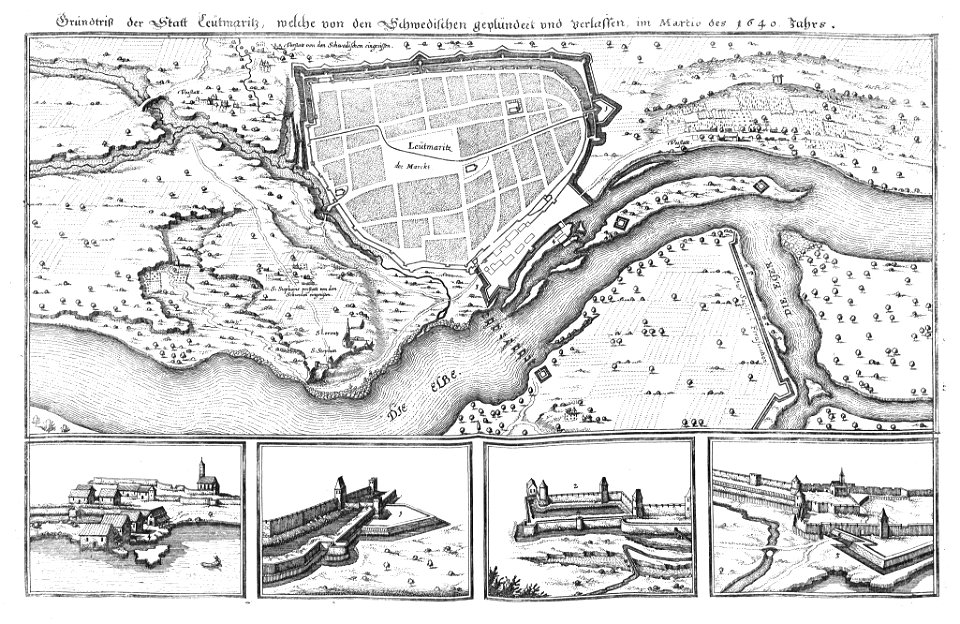
history of leutkirch im allgäu
maps of the thirty years' war
17th-century maps of maastricht
amby (maastricht)
maps made in the 18th century
cornelis danckerts (i)
pictorial history of the russian war 1854-5-6 by george dodd
historical images of kronstadt
friedrichshafen in art
maps of bodenseekreis
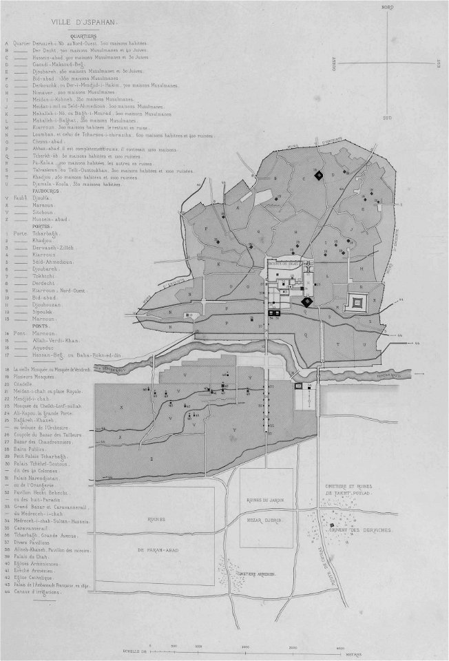
list of paintings and plots by pascal coste and eugène flandin
isfahan
notre-dame de la garde
braun & hogenberg
illustrations from le tour du monde by eugène flandin
volume 4 of le tour du monde
pictorial history of the russian war 1854-5-6 by george dodd
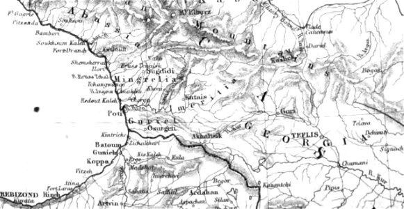
1856 maps of georgia
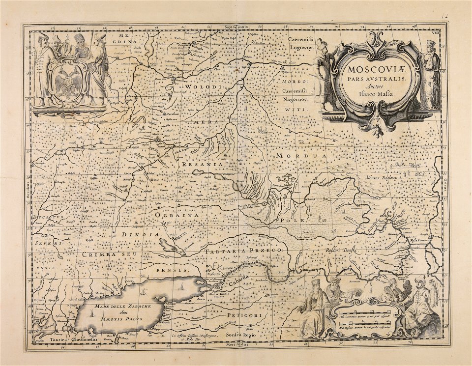
atlantis magni tomus primus (biblioteca comunale di trento)
maps made in the 17th century
history of the elbe
elbe in litoměřice
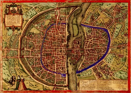
maps of paris by braun & hogenberg
paris in the 16th century
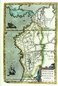
17th-century maps of south america
files from the bodleian libraries
cornelis danckerts (i)
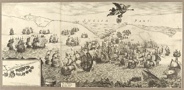
battle of the downs
historical images of minsk
minsk
maps in the library of congress
western europe
maps in the library of congress
western europe
maps in the library of congress
western europe
maps in the library of congress
western europe
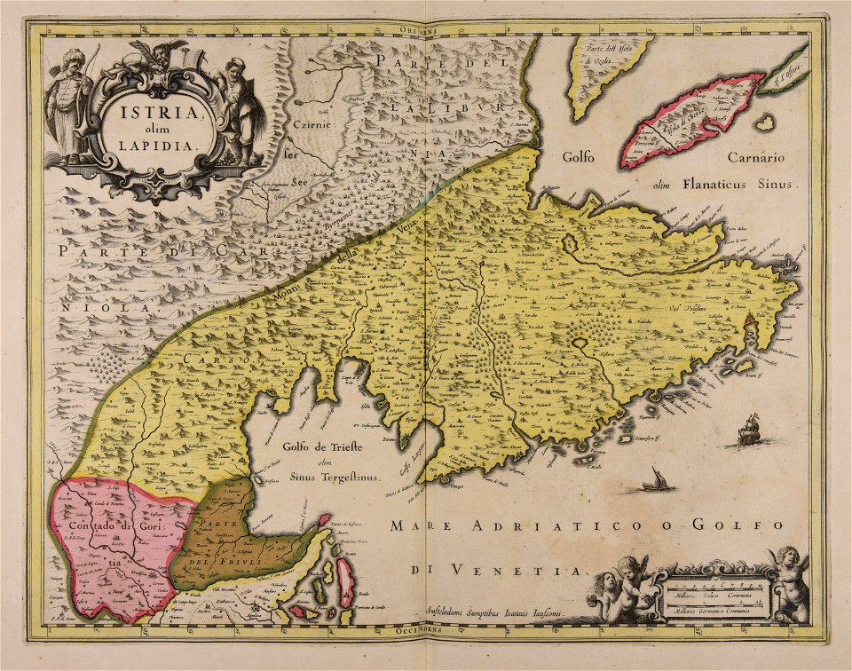
maps made in the 17th century
istria
printing
1848
maps made in the 17th century
nicolaes visscher ii
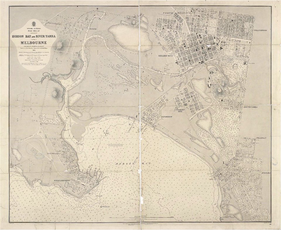
maps of melbourne
australia
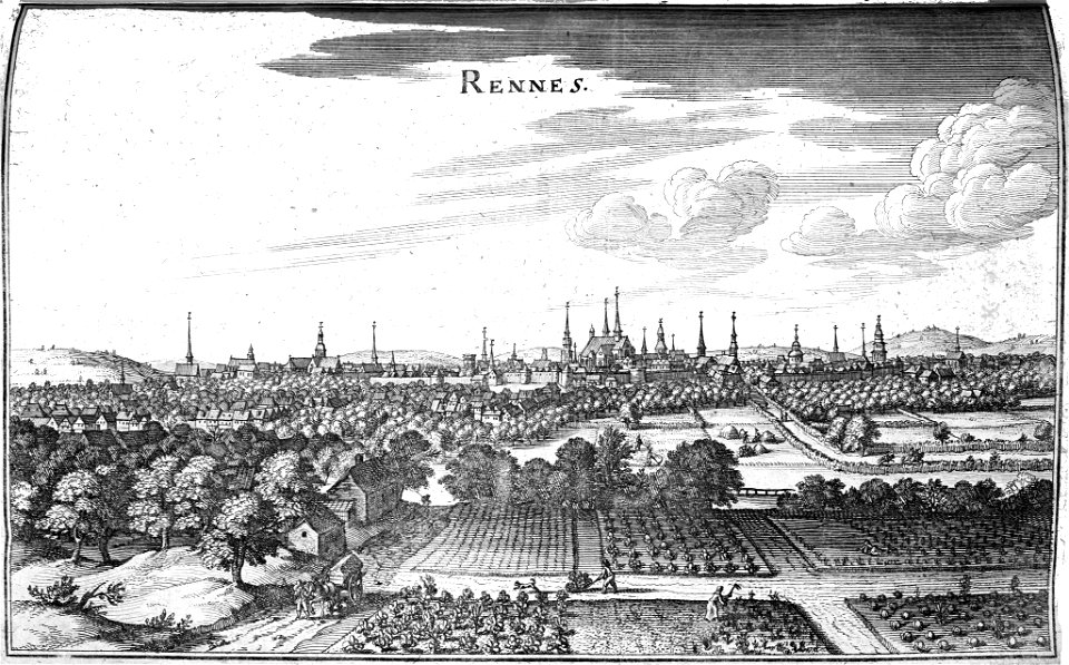
bibliothèque municipale de reims
rennes in art
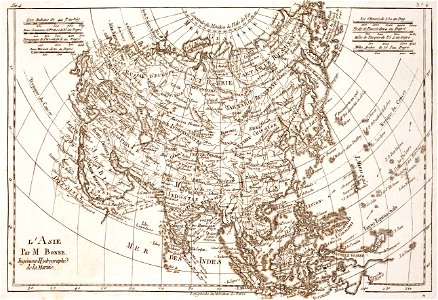
18th-century maps of asia
bonne projection
cornell: persuasive cartography: the pj mode collection
cornell university library
9601 - 9700 of 33,600
Next page
/ 336